Strathgartney Provincial Park Trails
Gallery
Quick Facts
| Difficulty | moderate |
| Trail Type | loops |
| Distance | 5.8 km mapped |
| Estimated Time | 2 hrs 30 mins |
| Surface Type | forested |
| Elevation Change | 82 meters |
| Features | river, fields, forest |
| Trail Markers | direction signs |
| Scenery Rating | beautiful |
| Maintenance Rating | well maintained |
| Cell Reception | strong |
| Dog Friendly | on a leash |
| Fees | none |
Store

Description
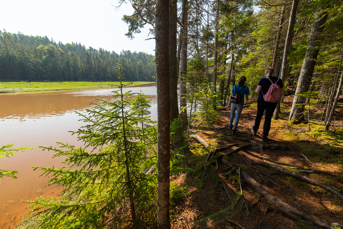
The main trail travels down through the field and soon enters the woods. A loop trail called the Cotton Valley - Gleann a Chotanaich Trail goes through the field in the other direction but eventually loops back around to the main trail just after the main trail enters the woods. There is another side loop trail that goes through the woods and follows a stream. The trail passes by an old truck that was abandaned here many years ago that has trees growing up through it. There is also what's left of an old car body down in the stream valley. The side trail meets back up with the main trail just before it reaches the corner of the field.

The main trail then turns to the left and crosses the bridge at the corner of the field. The Hemlock Hills and Rock and Roll Trails make interesting loops from the main trail. The trail travels through different forest types and along stream valleys. The main trail then travels fairly straight through the woods until you start to see the West River on the left.
You will soon come to a trail junction. Turning right will take you on the main trail up and away from the river. Continuing straight will take you onto the Goat Trail. The Goat Trail is the roughest trail in the park but also, in our opinion, the best trail in the park. It follows the edge of the woods out around a long narrow bow in the river. The point is surrounded by a grassy wetlands as the river flows along the opposite side of the valley. Along this section of trail we saw a family of blue herons and five bald eagles chasing each other up and down the edge of the river and play fighting.

After continuing around the loop the trail starts to climb away from the edge of the river valley. You will get a few more views before you once again meet up with the main trail. At this junction turning left will take you to Bonshaw Hills Provincial Park approximately 45 minutes. Turning right will take you to another intersection at this point if you turn right you will follow the main trail back to the river and up to the Lookout parking lot (approximately 45 minutes) If you turn left the Beech Trail will take you back to the Lookout parking lot in 20 minutes. This trail goes through a beautiful hardwood forest made up of mainly beech trees.
Map

Directions
When traveling through Bonshaw on the Trans Canada Highway (route 1) you will find the main entrance to Strathgartney Provincial Park across from Route 245. The civic number for the park entrance is 17025. When entering the park you can keep left to enter the parking lot called the lookout. The main trail drops down over the hill and into a field near the right of the parking lot.
You can also turn right when entering the park and drive down the park road through the field. A trail enters the woods in the corner of the field near the bathrooms. A trail also enters the woods about mid way across the back of the field.
The main trail can also be accessed from the main parking lot for Bonashaw Hills Provincial Park. Park your car near the playground and follow the main trail to the left until it goes under the highway.
Trail Last Hiked: July 4, 2019.
Page Last Updated: August 14, 2019.