Cedar Dunes Provincial Park Trails
Gallery

Quick Facts
| Difficulty | moderate |
| Trail Type | mixed |
| Distance | 5.4 km |
| Estimated Time | 3 hours |
| Surface Type | forested, sand |
| Elevation Change | 28 meters |
| Features | beach, lighthouse |
| Trail Markers | red signs |
| Scenery Rating | must see |
| Maintenance Rating | variable |
| Cell Reception | low |
| Dog Friendly | on a leash, not on beach |
| Fees | no |
Store

Description
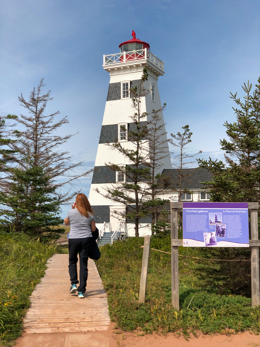
Cedar Dunes Provincial Park is on a point on the western edge of the island. It has a wharf on one side and a campground. The most exciting feature it has (in my opinion) is the tallest lighthouse in the province. The West Point Lighthouse also houses a museum that goes all the way to the top of the lighthouse. The views in all directions from the top of the lighthouse are well worth the fee. There is also a beach front inn off the side of the lighthouse that we want to go back to try out.
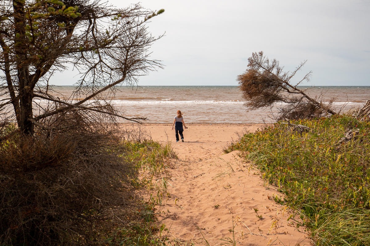
The beach starts at the wharf, goes in front of the campground, curls around the point and then passes in front of the lighthouse before extending another 2.5 kilometers to the north. It provides ample distance to take a long walk on the beach overlooking the Northumberland Strait.
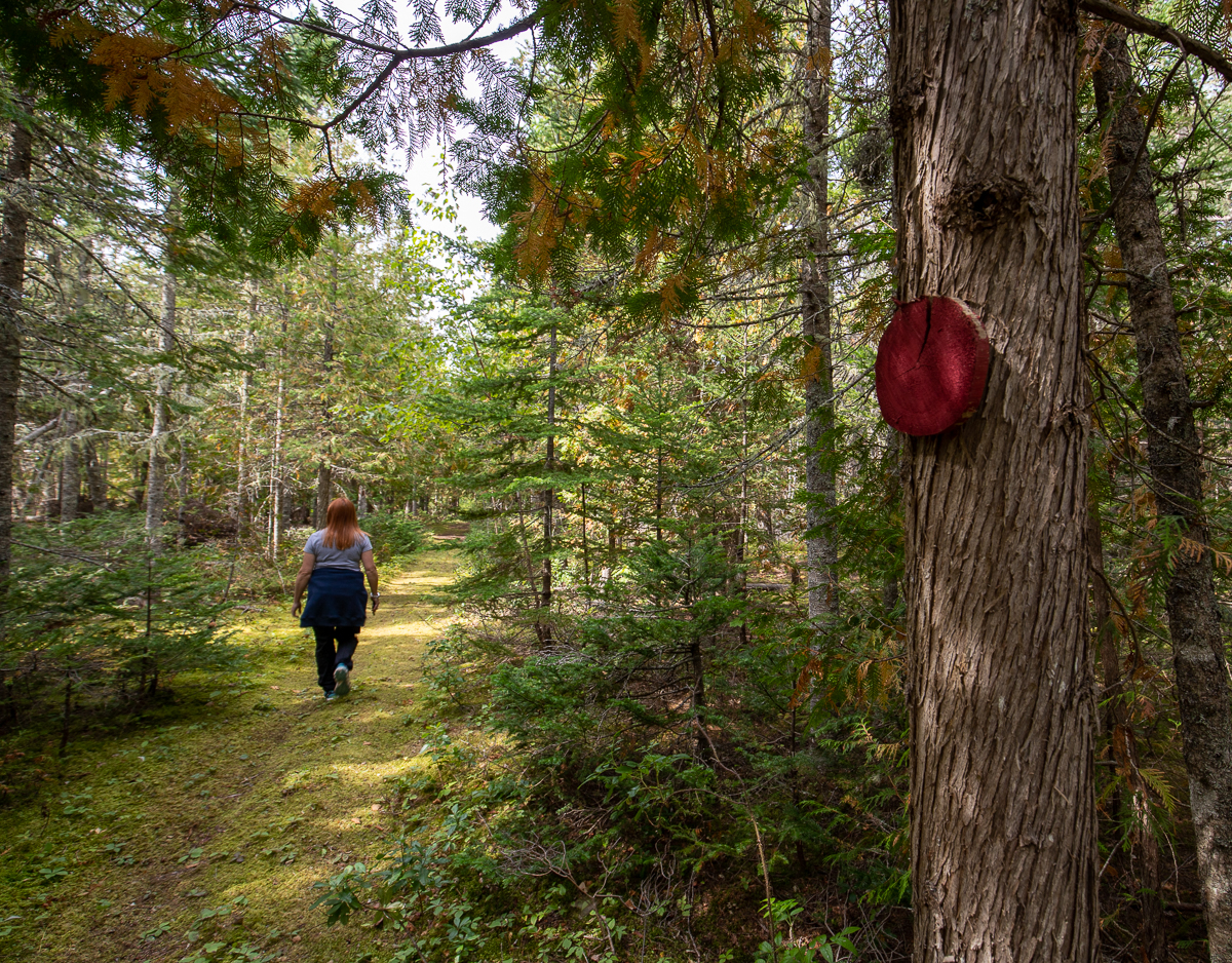
Behind the lighthouse there are wooded trails that go out to Cedar Dunes Park Road and back, on either side of a long narrow bog. The main trails are kept in good shape but there are several side trails that are not maintained. The trails start at the edge of the clearing by the parking lot, or on the beach to the north of the lighthouse. These trails are called Fairy Trails (see From the Sign) and travel through a mostly fir and cedar mixed forest. The trails are a good addition but the real walk is on the beach.
Note that if you are walking on the woods trails make sure you stay on the trails. We saw poison ivy on the side of one of the trails on our visit.
Map

Directions
From Glenwood, drive west on route 14 towards West Point. After 5.9 kilometers turn left onto Harbour Road. Drive 700 meters on Harbour Road. Just before the wharf turn right onto Cedar Dunes Park Road. Drive for 1.1 kilometers and you will come to a parking lot at the lighthouse. You can access the beach on the left by the start of the parking lot. The woods trails enter the woods at the back of the clearing on the right of the parking lot. The other end of the woods trails can be accessed from the beach beyond the lighthouse.
The other ends of the woods trails can be accessed from the Cedar Dunes Park Road (see map).
From the Sign
West Point Lighthouse
West Point Lighthouse, built in 1875, is PEI's tallest lighthouse at 67, feet 8 inches. The first of the "second generation lighthouse" (square-tapered towers built after P.E.I. joined Confederation in 1873), its broad black stripes (day marks) were originally painted red until 1915. From 1942-1945, the light was kept operational during the winter as a nighttime guide for pilots at the British Commonwealth Air Training Schools in nearby Mount Pleasant and Summerside. Until it was electrified in 1963, there were only two keepers in its 88 years as a staffed light: William Anderson MacDonald (1875-1925) and Benjamin MacIsaac (1925-1963). In 1984, the lighthouse was leased to the West Point Development Corporation and converted to an inn, restaurant (relocated to the harbour area in 2010) and museum.
From the Sign
Fairy Trails
We invite you to take a pleasant stroll along the Fairy Trails through the forest behind the lighthouse. According to legend, the little people, or fairies, used the paths for their walks, and that is why no trees have ever been known to grow there. The two main trails, Leprechaun Lane and Lady Slipper Walk, are located on opposite sides of the marsh with a number of smaller trails branching off from them. For a leisurely return walk, allow about one hour. You'll find plenty to explore here, like the small, secluded forest located directly behind the lighthouse known as Fairy Dell. Of course, not everything is shown on this map, such as buried treasure believed by many to be hidden in the area. Much of the pleasure derived from walking the paths is in discovery. So please accept our invitation,and - Explore and Enjoy.

From the Sign
The Shoreline
Coastal shorelines are formed by a combination of human interaction and environmental influences such as tide and wind. It is estimated that 1/3 of the erosion in West Point is caused by sea level rise. Since 1900, it has risen 30 cm; by 2010, it could rise as much as 70 cm. Sand Mining - the removal of sand for use in construction materials - has also contributed to the changing face of West Point. Built in the early 1900s, the West Point Wharf aids in replenishing the sand supply by trapping sand carried by the current from the west. In the 1970s, the wharf was rebuilt, its wooden structure replaced by steel and an eastern jetty added, trapping even more sand. Despite this, the rate of erosion to the shoreline east of the harbour has increased.

From the Sign
The Dunes
West Point's dune system is scenic, but fragile. Because of this fragility, it's critical for visitors to use only the boardwalk and official pathways when accessing the beach.

As erosion, shifting sands, and other factors change and in some cases diminish the dune system, a variety of natural aides attempt to maintain it. Foremost among these is Marram Grass (Ammophila breviligulata), a waxy grass with extensive water-seeking root systems. Ammophila is especially susceptible to damage by foot traffic. Creeping Juniper (Juniperus horizontalis) and Common Juniper (Juniperus communis) also grow here, helping to hold the dune system together. These plants survive because they are able to withstand strong winds and the salt water the winds carry. They are also adaptable to dry conditions, growing as they do in the well-drained sand.
From the Sign
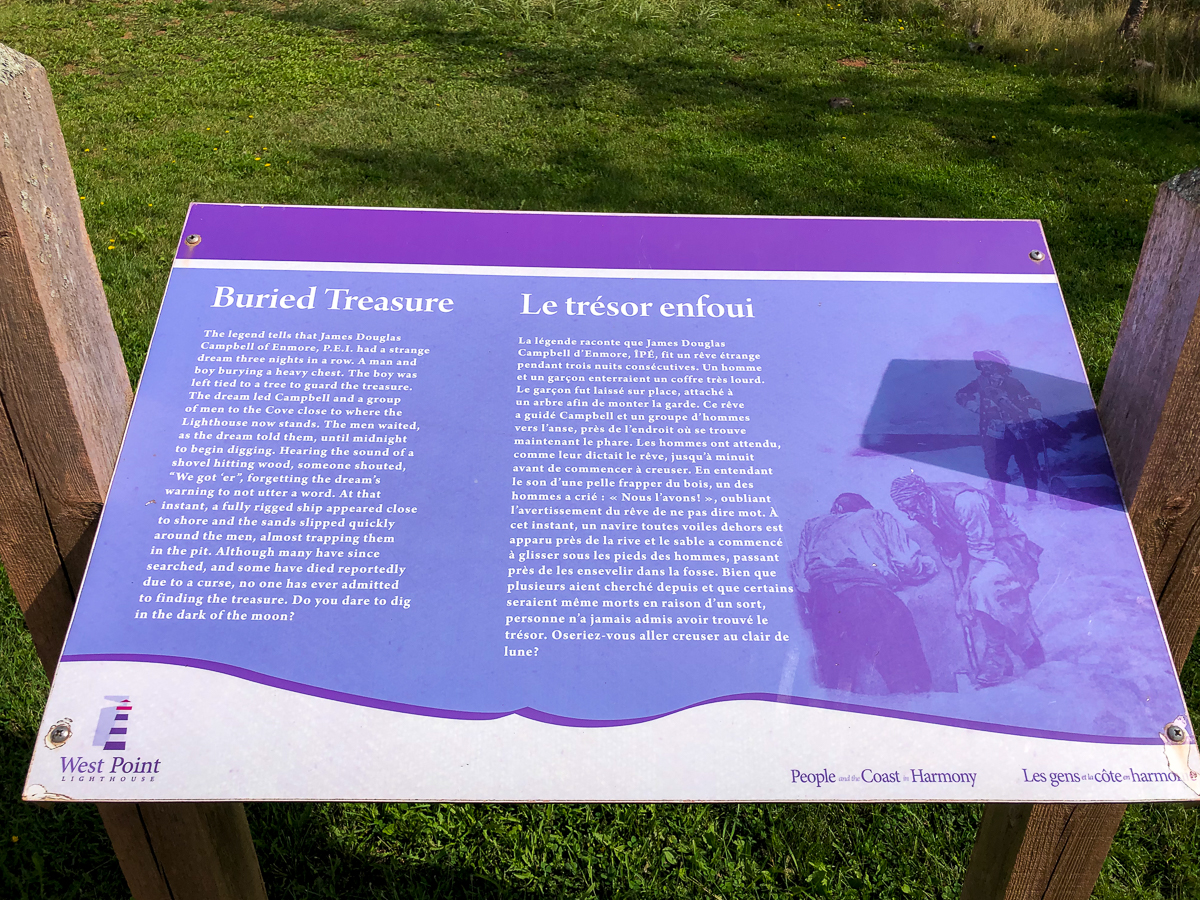
Buried Treasure
The legend tells that James Douglas Campbell of Enmore, P.E.I. had a strange dream three nights in a row. A man and boy burying a heavy chest. The boy was left tied to a tree to guard the treasure. The dream led Campbell and a group of men to the Cove close to where the Lighthouse now stands. The men waited, as the dream told them, until midnight to begin digging. Hearing the sound of shovel hitting wood, someone shouted, "We got'er", forgetting the dream's warning to not utter a word. At that instant, a fully rigged ship appeared close to shore and the sands slipped quickly around the men, almost trapping them in the pit. Although many have since searched, and some have died reportedly due to a curse, no one has ever admitted to find the treasure. Do you dare to dig in the dark of the moon?
Trail Last Hiked: September 13, 2020.
Page Last Updated: March 29, 2022.